Bill’s Mill Mistory
I decided to try to find out a little more about the Mill on Monkton Hill. As I said in my previous post I could find no trace of a place in Thanet called Monkton Hill except in the Barham story of Smuggler’s Leap (which in some earlier maps is marked as Thunnor’s Leap).
At the time of writing this, Wikipedia said of Sarre Windmill “Sarre windmill was built in 1820 by the Millwright John Holman. It was said to have been moved from Monkton, but it is more likely to have had some machinery from that mill included in its construction“.
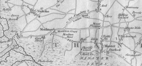
However the map immediately below published by J. Cary in 1810 clearly shows a Windmill (you might need your reading glasses to see it clearly as it is very small) at Sarre on pretty much exactly the same spot as it stands now. The first series of Ordnance Survey maps dated 1816 also shows the windmill at Sarr (Sarre). Note also the location of Minster Level. It will be mentioned again later in this post.
 Click on the image above to ENLARGE
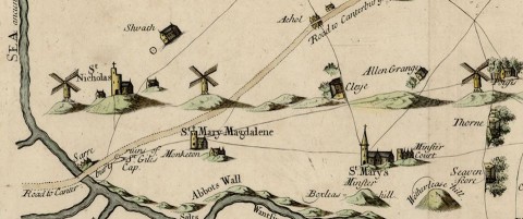
This much earlier map (below) by S. Parker was published in John Harris’ “History of Kent” circa 1717. As you will see the is no Windmill at Sarre, but one to the North of Monkton. However on the whole the placing of things seems to be quite haphazard and pretty much every item is embellished with its own hill.
 Click on the image above to ENLARGE
Then again another map from the 1770s (below) shows a Monkton Mill well to the North East of Monkton. I found a list of Windmills in Kent at:
http://en.wikipedia.org/wiki/List_of_windmills_in_Kent
which mentions a Monkton Mill, which is identified as having existed between 1596 and 1769.
 Click on the image above to ENLARGE
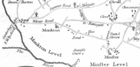
The image below from a map, which I understand dates from circa 1800 appears to show both Monkton Mill and Sarre Mill existing at the same time, albeit that both appear to be slightly out of position. I guess making maps was not easy without the advantage of aerial views.
 Click on the image above to ENLARGE
According to Barham, Bill’s route was Reculver, Chislet Lane, Up-street, Sarre Bridge, the Mill on Monkton Hill, Monkton Mead, Minster Level, and then while heading for Manston Cave (There is no sign of a cave near Manston on the maps, although there are internet references to pits and caves in the area), he ended up in the chalk pit, which people now identify as Smuggler’s Leap, just to the South of Acol (the three maps above contain different spellings of Acol).
Is it possible that Barham was working by candlelight late at night from a map such as the one immediately above and misread Monkton Mill as Monkton Hill?
According to a Google search I did just now, most references to Monkton Mead are to a place in the Isle of Wight. The only references to Monkton Mead in Thanet are in the Smuggler’s Leap story in the Igoldsby Legends.
In any event Bill must have taken a very circuitous route towards Manston in order to have suddenly found himself near Acol, when he had not long before been galloping over Minster Level. He must have been close to Acol, before he turned South towards Minster and then later turned North again. I guess he would not have been wanting to lead Exciseman Gill straight to his home.
In conclusion, the mill I built in my previous post, is almost certainly too modern to have even resembled Monkton Mill. Another Kent mill which seems to have appeared at around the same time as Monkton Mill can be viewed at:-
http://en.wikipedia.org/wiki/File:Shottenden_Perry_Wood_1914.jpg
Having done the construction work, I doubt if I will rebuild it now. This won’t be the first movie where dramatic effect and the need to get a move on will take precedence over historical accuracy.
Tony